---
title: Costa Rica Packing List (And What to Pack for Every Nayara)
description: In this article, we offer a look at the average climate and conditions at each of the Nayara Resorts, so you can be prepared for your stay and turn a great trip into an unforgettable one.
image: https://blog.nayararesorts.com/hubfs/Atacama%205.jpg
---
[Blog](https://blog.nayararesorts.com/)
[](https://nayararesorts.com/)
SUBSCRIBE
# Costa Rica Packing List (And What to Pack for Every Nayara)
[Albert Ghitis](https://blog.nayararesorts.com/author/albert-ghitis-1)
Feb 16, 2024
Key Findings
≈0 mm
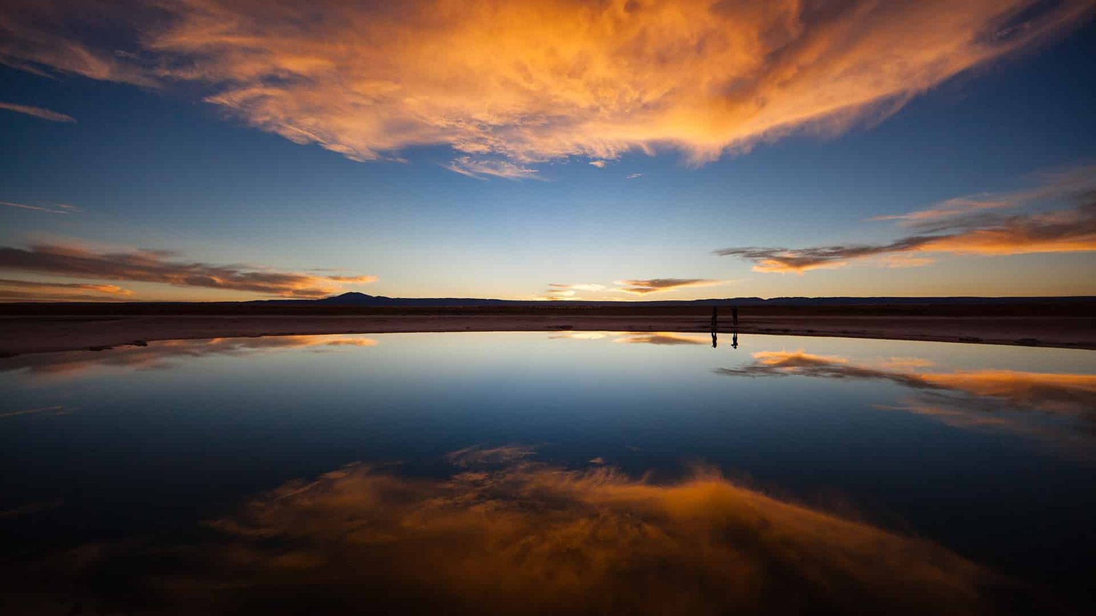
Annual rainfall in the Atacama, the driest nonpolar desert on Earth. Pack for hot days and near-freezing nights.
Mid-80s °F
Daily highs in Bocas del Toro every month of the year, thanks to its equatorial latitude.
Jan–Mar
Arenal's dry season. The rest of the year, rainforest showers come in short bursts and activities carry on.
In This Article
8 min read
[01Easter Island: Weather and What to Pack](https://blog.nayararesorts.com/climate-conditions-and-packing-tips-for-each-of-the-nayara-resorts#easter-island) [02Bocas del Toro: Weather and What to Pack](https://blog.nayararesorts.com/climate-conditions-and-packing-tips-for-each-of-the-nayara-resorts#bocas) [03The Atacama Desert: Weather and What to Pack](https://blog.nayararesorts.com/climate-conditions-and-packing-tips-for-each-of-the-nayara-resorts#atacama) [04Arenal: Weather and What to Pack](https://blog.nayararesorts.com/climate-conditions-and-packing-tips-for-each-of-the-nayara-resorts#arenal) [05Tailor Your Packing List](https://blog.nayararesorts.com/climate-conditions-and-packing-tips-for-each-of-the-nayara-resorts#contact) [06Frequently Asked Questions](https://blog.nayararesorts.com/climate-conditions-and-packing-tips-for-each-of-the-nayara-resorts#faq)
Four Destinations, Four Climates
## What Is the Weather Like on Easter Island?
**In short:** Easter Island is temperate and mild year-round. Bocas del Toro holds tropical mid-80s highs every month. The Atacama swings from hot desert days to near-freezing nights with functionally zero rain. And Arenal is a warm rainforest with a January-to-March dry season. Pack layers for Chile, tropics-ready clothing for Panama and Costa Rica, and a light rain shell everywhere but the desert.
Wandering under the canopy of the Arenal rainforest as birds flit by in the trees. Hiking the mountainsides of Easter Island and gazing upon the ancient Moai as the sun sets. Paddling through the "Galapagos of the Caribbean" under a clear blue sky. Looking up into the shockingly clear Atacama night to see stars like you have never seen them before.
It is easy to imagine yourself in these places. Being prepared for the climate and conditions, though, can be the difference between a great trip and one you will remember for the rest of your life. This guide covers the weather at each of the four Nayara destinations—[Easter Island](https://nayarahangaroa.com), [Bocas del Toro](https://nayarabocasdeltoro.com), the [Atacama Desert](https://nayaraaltoatacama.com), and the [Arenal rainforest](https://nayaragardens.com)—with packing tips to get you started.
.jpg?width=720&height=432&name=Nayara%20Resorts%20(4).jpg)
Easter Island: temperate, breezy, and remarkably steady year-round.
### Average Monthly Temperatures on Easter Island
.png?width=720&height=450&name=Nayara%20Resorts%20(7).png)
Chart: [WeatherSpark, Average Weather on Easter Island](https://weatherspark.com/y/150391/Average-Weather-in-Easter-Island-Chile-Year-Round)
### Average Chance of Rain on Easter Island
.png?width=720&height=470&name=Nayara%20Resorts%20(8).png)
Chart: [WeatherSpark, Average Weather on Easter Island](https://weatherspark.com/y/150391/Average-Weather-in-Easter-Island-Chile-Year-Round)
Easter Island's average temperatures reach their highest during the Southern Hemisphere's summer months of January, February, and March, and their lowest in August. Throughout the year, though, the climate is temperate and pleasant, with very little variation between high and low temperatures. The daily chance of rainfall picks up slightly between April and June, but these are typically brief showers that pass quickly, leaving most of the day dry.
### What Should I Pack for Easter Island?
Easter Island blends temperate and tropical conditions depending on the day. Bring clothes for warmer temperatures (highs in the high 70s and low 80s) as well as a light jacket or pants for comfort in the evenings. Pack for warm weather if you are visiting in the Southern Hemisphere's summer, and for slightly cooler temperatures during the island's cooler months.
Panama
## What Is the Weather Like in Bocas del Toro?
.jpg?width=720&height=432&name=Nayara%20Resorts%20(3).jpg)
Bocas del Toro: equatorial warmth in every season.
### Average Temperatures in Bocas del Toro
.png?width=720&height=422&name=Nayara%20Resorts%20(2).png)
Chart: [WeatherSpark, Average Weather in Bocas del Toro](https://weatherspark.com/y/16751/Average-Weather-in-Bocas-del-Toro-Panama-Year-Round)
### Precipitation in Bocas del Toro
.png?width=720&height=394&name=Nayara%20Resorts%20(6).png)
Chart: [WeatherSpark, Average Weather in Bocas del Toro](https://weatherspark.com/y/16751/Average-Weather-in-Bocas-del-Toro-Panama-Year-Round)
Thanks to its equatorial location, temperatures in Bocas del Toro are essentially the same all year round: highs in the mid-80s and lows in the low 70s. Whatever time of year you visit, you can count on weather made for swimming and long afternoons on the water. Rainfall is slightly elevated in the latter portion of the year, but the rains tend to come in short bursts, with sunny conditions through the day and scattered showers that are a pleasure to watch from the deck of an overwater villa.
### What Should I Pack for Bocas del Toro?
Planning for the tropics will not lead you wrong. Pack swimsuits, warm-weather clothing, trekking shoes if you want to hike the other islands of the archipelago, and sunblock. A light raincoat to carry in your backpack for sporadic showers is another smart option, and you can rest assured that bug protection is handled both on the shores of Nayara Bocas del Toro and on any excursions.
"Four destinations, four climates: a volcanic island, an equatorial archipelago, the driest desert on Earth, and a rainforest
The right suitcase looks different for each one."
Chile
## What Is the Weather Like in the Atacama Desert?
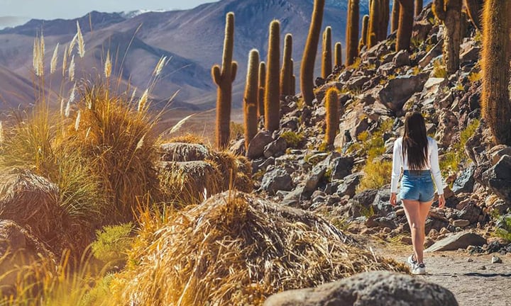
The Atacama: hot in the sun, near freezing after dark.
### Average Temperatures in the Atacama Desert
.png?width=720&height=468&name=Nayara%20Resorts%20(4).png)
Chart: [WeatherSpark, Average Weather in San Pedro de Atacama](https://weatherspark.com/y/27339/Average-Weather-in-San-Pedro-de-Atacama-Chile-Year-Round)
### Precipitation in the Atacama Desert
.png?width=720&height=469&name=Nayara%20Resorts%20(1).png)
Chart: [WeatherSpark, Average Weather in San Pedro de Atacama](https://weatherspark.com/y/27339/Average-Weather-in-San-Pedro-de-Atacama-Chile-Year-Round)
The Atacama is the driest nonpolar desert on Earth, and even these climate readings from nearby San Pedro de Atacama do not quite capture how little rainfall touches the region—which is functionally zero. The key consideration is the swing between high and low temperatures throughout the year. Average highs reach the low 80s, but the numbers spike considerably out in the sun or trekking in the desert, and drop very quickly after sunset, down to near freezing in the Southern Hemisphere's winter months.
### What Should I Pack for the Atacama Desert?
Plan for both ends of the thermometer: clothes set out for daytime trekking and excursions, and cold-weather layers for evenings around the resort or stargazing. Certain excursions require more robust gear, which we [lay out on page 3 of our tour book](https://nayaraaltoatacama.com/wp-content/uploads/2023/10/Tour-Book-Nayara-NAA-Ingles-Octubre-2023.pdf). Whatever your chosen excursions, bring a swimsuit for the pool in the Nayara Oasis.
Costa Rica
## What Is the Weather Like in Arenal?
.jpg?width=720&height=432&name=Nayara%20Resorts%20(2).jpg)
Arenal: a quintessential tropical rainforest, warm the whole year.
### Average Temperatures in the Arenal Region
.png?width=720&height=430&name=Nayara%20Resorts%20(5).png)
Chart: [WeatherSpark, Average Weather in La Fortuna](https://weatherspark.com/y/15526/Average-Weather-in-La-Fortuna-Costa-Rica-Year-Round)
### Precipitation in the Arenal Region
.png?width=720&height=326&name=Nayara%20Resorts%20(3).png)
Chart: [WeatherSpark, Average Weather in La Fortuna](https://weatherspark.com/y/15526/Average-Weather-in-La-Fortuna-Costa-Rica-Year-Round)
The Arenal rainforest is a quintessential tropical rainforest, with high temperatures throughout the year and moderate sustained rainfall, except in January, February, and March—the region's dry season. Like in Bocas del Toro, rain usually comes in short bursts, and activities typically continue unaffected. In the rainforest, an afternoon shower is simply part of life.
### What Should I Pack for Arenal?
We recommend moisture-wicking clothes suited to tropical climates. Even on days without rain, there can be mist and humidity under the canopy, so clothes suited to these conditions, plus a light rain jacket for your backpack, will help you enjoy Arenal to the fullest. Bring swimwear for lounging by the pool and in the natural hot springs, as well as clothes suited to trekking if you are inclined to join forest walks and similar expeditions.
Before You Zip the Bag
## Tailor Your Packing List
Depending on the time of year, the projected weather for the month, and your chosen excursions, our reservations team can help you tailor your packing list even further—so you travel light and efficiently with all the essentials covered.
To learn more, reach out to us at [reservations@nayararesorts.com](mailto:reservations@nayararesorts.com) or +1 844 865 2002.
Frequently Asked Questions
Does it ever rain in the Atacama Desert?+
Functionally, no. The Atacama is the driest nonpolar desert on Earth, and annual rainfall around San Pedro de Atacama is close to zero. What you plan for instead is the temperature swing: hot days in the sun and near-freezing nights in the Southern Hemisphere's winter.
When is the dry season in Arenal, Costa Rica?+
January through March. The rest of the year brings moderate rainfall, usually in short bursts, and activities typically continue unaffected. Temperatures stay warm year-round.
What is the best time of year to visit Bocas del Toro?+
Any time. Bocas del Toro's equatorial location keeps highs in the mid-80s and lows in the low 70s every month of the year. Rainfall rises slightly late in the year but comes in short bursts between sunny stretches.
How cold does Easter Island get?+
Not very. The island's climate is temperate year-round, with highs in the high 70s to low 80s in summer and its coolest month in August. A light jacket or pants covers the evenings; heavy cold-weather gear is unnecessary.
Begin
## Choose Your Climate
Four destinations, four climates, one collection. Explore the world of Nayara.
[Easter Island](https://nayarahangaroa.com) [Bocas del Toro](https://nayarabocasdeltoro.com) [Atacama](https://nayaraaltoatacama.com) [Arenal](https://nayaragardens.com)
[.jpg)](https://blog.nayararesorts.com/earth-in-focus-a-journey-through-our-changing-landscapes)
## [Earth in Focus | A Journey Through Our Changing Landscapes](https://blog.nayararesorts.com/earth-in-focus-a-journey-through-our-changing-landscapes)
Aug 23, 2024
[](https://blog.nayararesorts.com/7-michelin-keys-3-countries-1-commitment)
## [7 MICHELIN Keys. 3 Countries. 1 Standard of Excellence](https://blog.nayararesorts.com/7-michelin-keys-3-countries-1-commitment)
Mar 1, 2026
[](https://blog.nayararesorts.com/creating-unforgettable-family-travel-with-nayara)
## [Luxury Family Resorts: Family Travel Across Nayara's Collection](https://blog.nayararesorts.com/creating-unforgettable-family-travel-with-nayara)
Mar 7, 2024
- [Nayara Gardens](https://nayaragardens.com/)
- [Nayara Springs](https://nayarasprings.com/)
- [Nayara Tented Camp](https://nayaratentedcamp.com/)
- [Nayara Alto Atacama](https://www.altoatacama.com/)
- [Nayara Hangaroa](https://www.hangaroa.cl/)
- [Nayara Bocas Del Toro](https://bocasbali.com/)
-
-
-
-
-
-
- [Costa Rica +506 2479-1600](tel:+50624791600)
- [US +1 844-865-2002](tel:+18883322961)
- [UK +44 1617918120](tel:+441617918120)
```json
{
"@context" : "https://schema.org",
"@type" : "BlogPosting",
"author" : {
"@type" : "Person",
"name" : "Albert Ghitis",
"url" : "https://blog.nayararesorts.com/author/albert-ghitis-1"
},
"dateModified" : "2026-08-02T17:35:31.476Z",
"datePublished" : "2024-02-16T19:46:21.000Z",
"headline" : "Costa Rica Packing List (And What to Pack for Every Nayara)",
"image" : [ "https://blog.nayararesorts.com/hubfs/Atacama%205.jpg" ],
"mainEntityOfPage" : {
"@id" : "https://blog.nayararesorts.com/climate-conditions-and-packing-tips-for-each-of-the-nayara-resorts",
"@type" : "WebPage"
},
"publisher" : {
"@type" : "Organization",
"logo" : {
"@type" : "ImageObject",
"url" : "https://blog.nayararesorts.com/hubfs/Captura%20de%20pantalla%202023-04-13%20a%20la(s)%2010.55.13.png"
},
"name" : "Nayara Resorts"
}
}
```