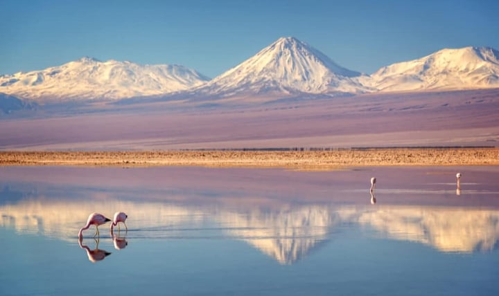
Flamingo species nesting in Atacama salt flats, all vulnerable or near threatened, from mining and water extraction, not natural scarcity.
Marine species found nowhere but Rapa Nui, whose community voted in 2018 to protect their waters in one of the largest MPAs ever created.
Square kilometers of ocean the Rapa Nui Marine Protected Area shields, roughly the size of Chile's entire landmass.
What Extreme Aridity Means for Conservation
In short: Chile's two Nayara landscapes sit at the far edge of what life can tolerate. The Atacama is the driest nonpolar place on Earth, yet its high-altitude lagoons sustain flamingos, vicúnas, and culpeo foxes adapted over millions of years. Rapa Nui, more than 3,500 kilometers from any continent, holds at least 142 marine species found nowhere else, protected since 2018 in a 720,000-square-kilometer marine reserve the community itself created.
In Part 1 we explored the conservation work behind the biodiversity of Costa Rica's Arenal region and Panama's Bocas del Toro: ecosystems defined by abundance, density, and the visible complexity of tropical life. Part 2 moves to the opposite end of the spectrum.
Chile's geography produces extremes almost without parallel. The Atacama in the north is the driest nonpolar environment on Earth. Rapa Nui, known internationally as Easter Island, sits more than 3,500 kilometers from the nearest continent in one of the most nutrient-poor stretches of the Pacific. In both places, life exists not in spite of the conditions but because of adaptations refined over millions of years to exploit them.
Some weather stations in the Atacama have never recorded measurable precipitation in their entire operational history. Not a drought. Not an anomaly. A permanent condition. And yet the desert is alive. Flamingos breed in its salt lagoons. Vicúnas graze its high plains on blood that carries oxygen more efficiently than any other large mammal on Earth. Foxes, viscachas, and lizards thread through its rocky margins in thermal windows so narrow that a few degrees in either direction would kill them.
The dryness is not uniform. The hyperarid core, where NASA uses the landscape as a Mars analog, sits between the cold Humboldt Current to the west, which suppresses Pacific rainfall, and the Andes to the east, which block Amazon moisture. The result is a vertical gradient: lower elevations are nearly sterile, but zones above 3,000 meters receive snowmelt and geothermal input that sustains permanent wetlands, salt lagoons, and the food webs that depend on them. Read: The Atacama Is Mars on Earth ↗
Flamingos: Indicators of Wetland Integrity
Three flamingo species nest in the Atacama's salt-flat lagoons: the Andean, the Chilean, and James's. All three are listed as vulnerable or near threatened by BirdLife International, not because the desert is getting drier, but because human activity is degrading the specific water bodies their breeding depends on. The Andean flamingo, rarest of the three, has experienced documented declines tied directly to mining disturbance and water extraction at key nesting sites.
These flamingos are not simply beautiful. They are functional indicators of wetland health. Their filter-feeding, straining brine shrimp and algae from hypersaline water, depends on a precise balance of salinity, depth, and food. When water extraction or chemical contamination from nearby mining disturbs that balance, flamingo breeding fails first. Their absence from a lagoon they once occupied is one of the clearest early signals that the wetland is deteriorating.
At Nayara Alto Atacama, excursions to the salt-flat lagoons at Chaxa and Miscanti are built around minimal-disturbance protocols. Flamingos are sensitive to ground-level noise and movement during nesting season, so observing them from the right distances at the right times is not a restriction on the guest experience. It is the thing that makes the experience possible year after year.
Camelids of the High Andes
Guanacos and vicúnas are among the most physiologically specialized large mammals on Earth. Where oxygen partial pressure is roughly 40 percent lower than at sea level, both species sustain aerobic performance through unusually high hemoglobin concentrations and blood oxygen-carrying capacity, as documented by the Smithsonian National Zoo. Their digestive systems pull water from vegetation so efficiently that they survive on the sparse altiplano without standing water.
Those adaptations make them resilient to natural stress. They do not make them resilient to hunting, habitat conversion, or competition from domestic livestock. Vicúnas were hunted to near-extinction for their extraordinarily fine fiber after European contact, and recovery has been slow and uneven. Their Atacama populations are stable in protected areas but remain vulnerable wherever land-use pressure and enforcement waver.
Llamas occupy a different place in this ecosystem. Domesticated from guanacos roughly 6,000 years ago by Andean cultures, they are at once wildlife, livestock, and cultural heritage. Our on-site llama corral connects guests with that history directly, not as a zoo exhibit, but as a living record of the human-animal relationship that sustained Andean civilization for millennia. Their continued presence is itself a conservation of living culture.
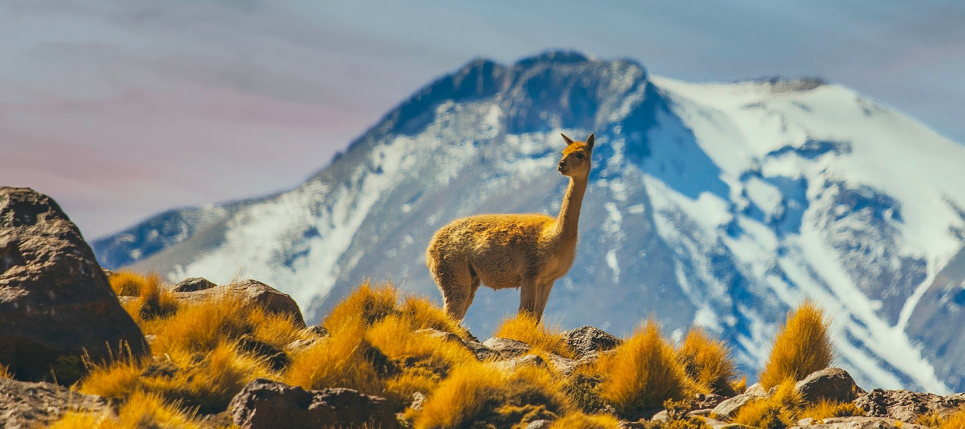 At altitudes where oxygen runs 40 percent thinner, the vicúna's blood carries it better than any other large mammal.
Conservation that protects flagship species while degrading the habitat that supports everything else is not conservation. It is decoration.
Small Fauna: The Desert's Invisible Architecture
The culpeo fox, the viscacha, and the lizard communities of the Atacama draw far less attention than flamingos or camelids. They are harder to photograph and less iconic. But they perform the trophic and behavioral functions that hold the ecosystem together.
The culpeo is the desert's primary mid-level predator, regulating rodents, scavenging carrion, and shifting its diet across seasons and elevations. Viscachas, high-altitude rodents that resemble chinchillas, disperse seeds, feed multiple predators, and build burrow systems that become microhabitats for other animals. The lizards documented by the IUCN in the rocky margins are ectotherms living at the edge of thermal tolerance, surviving by behavioral precision: emerging to forage in narrow thermal windows and retreating before the heat exceeds their limits.
None of these species is individually charismatic. Together, they are the functional diversity that decides whether the desert can absorb disturbance or collapse under it.
Isolation as Both Refuge and Vulnerability
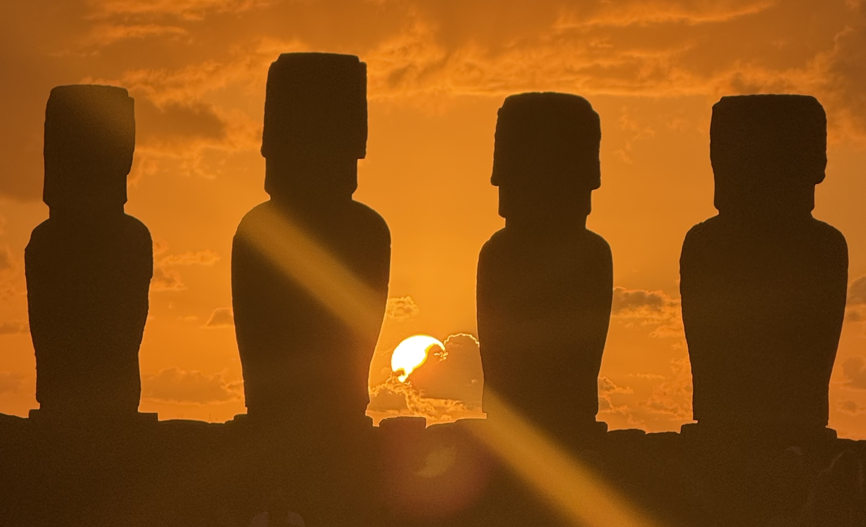
Easter Island is the most isolated inhabited island on Earth. Its nearest neighbor, Pitcairn Island, is more than 2,000 kilometers away. The island is the exposed peak of a massive submarine volcano in the Salas y Gómez Ridge, a chain of seamounts that the Schmidt Ocean Institute has documented as creating conditions for extraordinary marine biodiversity in an otherwise nutrient-poor sea.
Isolation produces endemism: species that exist only here. The waters around Rapa Nui harbor at least 142 species found nowhere else, and the California Academy of Sciences has run deep-reef expeditions here that found species entirely new to science. The land tells a different story. Most native land species, the palm forests that once covered the island, the vast seabird colonies, were lost after human settlement. What remains on land is a heavily modified ecosystem. And in it, wild horses outnumber people.
Wild Horses and Cultural-Ecological Identity
Easter Island's wild horses sit in an unusual category. They are not native. They are not recent. And they are not going away. Horses arrived in the 1860s, introduced by Catholic missionaries who, unlike earlier European visitors, intended to stay. Their arrival coincided with the most catastrophic period in the island's human history.
In December 1862, Peruvian slave raiders struck repeatedly over several months, capturing roughly 1,500 people, about half the population. Among them were the paramount chief, his heir, and virtually everyone who could read rongorongo, the only written language ever developed in Polynesia. International outcry forced Peru to repatriate survivors, but the return voyage became an incubator for smallpox and dysentery: of 470 people placed on a single ship built for 160, only 15 reached home alive, and the epidemic they carried killed roughly 1,000 more. By 1877, the island's population had collapsed to 111 people.
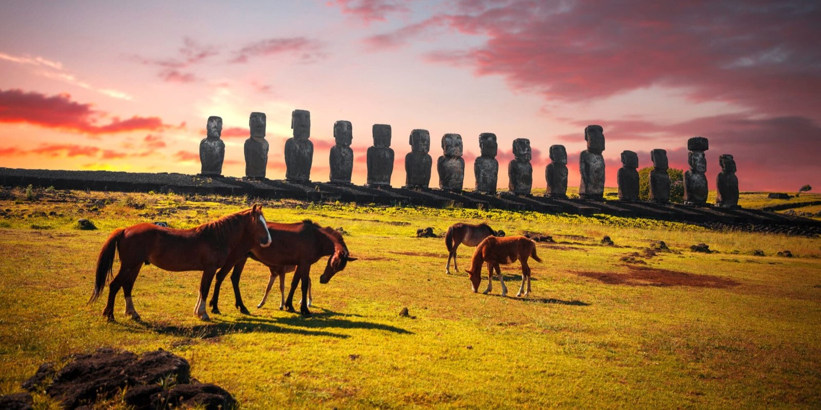
As the human population contracted, unmanaged horses multiplied. Today they roam the entire island freely, grazing volcanic slopes, walking through the only town, moving across one of the most significant archaeological landscapes on Earth. It comes at a cost. Research on soil erosion at Rapa Nui identifies overgrazing by horses and cattle as a primary driver of ongoing land degradation, compounding centuries of deforestation. Their grazing alters vegetation on an island where native plant communities already occupy less than 5 percent of the land, and their movement through archaeological sites erodes the ahu, the ceremonial platforms, and the ground around the moai.
And yet the horses have become inseparable from the island's identity. For the Rapa Nui community, whose population was nearly annihilated by the same colonial forces that introduced the horses, these animals are more than an ecological variable. They are woven into daily life: used for transport where vehicles are restricted, central to the tourism economy, present in nearly every visitor's photographs. Children grow up riding them. Families brand and own them. The horses occupy a space somewhere between wildlife and inheritance, a living reminder of a period that nearly erased everything else.
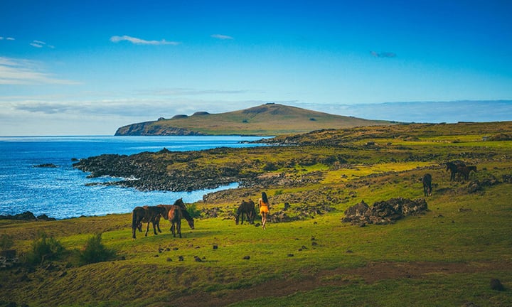 On the most isolated inhabited island on Earth, wild horses now outnumber people.
A Marine Protected Area, Rapa Nui Led
In 2018, the Chilean government signed the decree creating the Rapa Nui Marine Protected Area, a zone of 720,000 square kilometers, roughly the size of Chile's entire land area, shielding the waters around the island from industrial fishing, mining, and other extractive activity. It was not imposed from outside. The Rapa Nui community proposed it, developed it through years of meetings and environmental education, and endorsed it in a public referendum in which 73 percent of residents voted in favor.
That matters as a model as much as an outcome. The Pew Bertarelli Ocean Legacy, which supported the effort from 2012, worked alongside Rapa Nui leaders rather than leading them. The result preserves traditional artisanal fishing while excluding industrial extraction, the distinction between conservation that sustains a community and conservation that displaces one. The protected waters hold at least 27 threatened or endangered species, spawning grounds for tuna, marlin, and swordfish, and the only hydrothermal vents in Chilean territorial waters. For the island's endemic marine species, the ura lobster, the Easter Island butterflyfish, cephalopods found nowhere else, the MPA is the difference between a future and extinction by industrial attrition.
Among the species it shields are the green and hawksbill sea turtles that feed in the bays around Hanga Roa. The Rapa Nui call them honu. Turtle bones have been found alongside the oldest human remains on the island. Their images appear in petroglyphs at Tongariki and Orongo, and in the undeciphered glyphs of the rongorongo tablets. In the island's founding myth, the seven explorers sent by King Hotu Matu'a met a turtle spirit upon first landing at what is still called Hanga Ho'onu, Turtle Bay.
Once, turtle meat was reserved for the ariki, the paramount chief, during sacred rituals. Today the community has voluntarily abandoned turtle consumption entirely. The honu went from ceremonial offering to protected symbol in a single cultural generation, proof that conservation here is not imported policy. It is indigenous instinct.
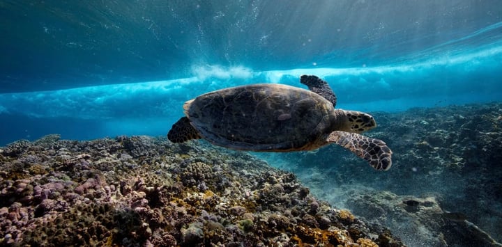
The honu appears in the island's oldest petroglyphs, its founding myth, and its protected waters.
What These Landscapes Teach
The Atacama and Rapa Nui produce wildlife through entirely different mechanisms: one through physiological adaptation to scarcity, the other through the endemism isolation generates over geological time. What they share is that the species surviving here are irreplaceable. They exist in no other form, in no other place. Their loss would not be a reduction in global biodiversity. It would be the permanent elimination of evolutionary experiments that took millions of years to produce.
The Andean flamingo has no backup habitat. The ura lobster exists in no other ocean. The vicúna's oxygen-adapted hemoglobin is the product of a specific evolutionary history in a specific place. At Nayara Alto Atacama and Nayara Hangaroa, we operate with that irreversibility as a baseline assumption. The guest experience we offer is built on the ecological integrity of these places, and protecting it is not a side commitment. It is the foundation.
Once the conditions that sustain these things are gone, no amount of subsequent effort recovers them. That is what World Wildlife Day actually means. Not a calendar date. A decision repeated every morning in places most people will never see.
Frequently Asked Questions
Why is the Atacama Desert so dry?+
What wildlife can you see in the Atacama Desert?+
Are the flamingos in the Atacama threatened?+
What is the Rapa Nui Marine Protected Area?+
What makes Rapa Nui's marine life unusual?+
Are Easter Island's wild horses native?+
Can guests interact with llamas at Nayara Alto Atacama?+
World Wildlife Day, United Nations · NASA Earth Observatory: Atacama Desert · Smithsonian National Zoo: Camelid Research · BirdLife International: Andean Flamingo · IUCN Red List · Schmidt Ocean Institute: Salas y Gómez Ridge · California Academy of Sciences: Rapa Nui · Pew Bertarelli Ocean Legacy: Rapa Nui MPA
Stand at the edge of what life can bear
The driest desert on Earth and the most isolated island in the Pacific, each with a Nayara resort built to protect it.